Custer's Decision
|
Battlefield Terrain The Little Bighorn River effectively divided the battlefield into two parts. The land north of the river was mountainous and rough, with Custer's troops routinely having to scale ridges and traverse ravines. The land south of the river was almost the opposite, with a wide prairie, and a few round hills. The river itself was lined with cottonwood trees and bushes. 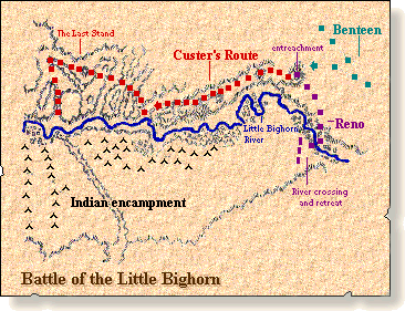
The routes of Custer's three groups
The Advance Custer's and Reno's attacks were supposed to be coordinated, but Custer was unaware of the amount of bluffs and ravines on his side of the river, and was substantially slowed down. As Reno's force engaged the Indians and eventually retreated across the river, Custer continued to make his way towards the Indian camp. Custer's initial attempt to cross the Little Bighorn River into the camp was repulsed by a contingent of Indian sharpshooters, and Custer broke off and kept on moving along the north side of the river. If Custer had successfully crossed the river into the camp, a hostage situation would have drawn concerned Indian warriors back to the camp, and may have even led to a victory. After a second failed crossing attempt, Indian warriors from the camp and warriors returning from Reno's advance swiftly surrounded and trapped Custer's force into the land around Last Stand Hill. |
The unique geography of the battlefield influenced Custer to split up his army which led to its separation and defeat.
The Split Custer split his army into three groups, himself, Major Reno and Captain Benteen. Custer approached the camp from the north and crossed the river into the camp, "Ordered Reno to take his command and try to overtake the Indians and bring them to battle while he himself would support him." Reno would attack directly from the south with Custer's support from the North, and Benteen would prevent the Indians from escaping. 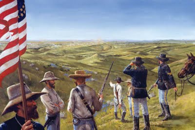
Custer and his men surveying the battlefield
Direct Effect Of Geography The massive differences in geography between both sides of the river severely disadvantaged Custer, because the Indians were able to engage him and Reno separately, leading to Custer's crushing defeat. The Little Bighorn River was also a key factor, and even though crossing it was possible, it would have left Custer's forces vulnerable to an Indian attack. The rough terrain north of the river and the prairie south of it led to a failure to capture the camp, and the speedy demise of Custer's troops. |